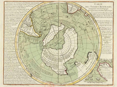

The Buache Map is an 18th century map commonly claimed to accurately depict the continent of Antarctica before it was buried by ice.
Get Started for FREE
Sign up with Facebook Sign up with X
I don't have a Facebook or a X account


 Your new post is loading...
 Your new post is loading...
Your new post is loading...
The Buache Map is an 18th century map commonly claimed to accurately depict the continent of Antarctica before it was buried by ice. 
No comment yet.
Sign up to comment
|